For Land Surveying Firms
Your point cloud data,
turned into precise Revit models.
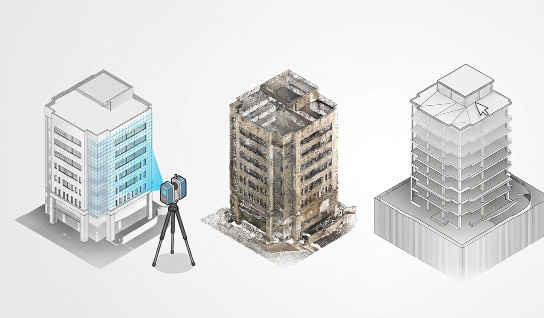
White-label scan-to-BIM modeling that sits behind your brand. You keep the client relationship. We do the modeling.
Every project starts with a fixed scope and price before we touch your data.
First project? Ask about our introductory rate.
Most surveying firms are asked for BIM deliverables more often than they can staff for. ZCscan is the modeling team working quietly behind your proposals, so you can say yes without hiring, training, or slowing down a scan-heavy season.
What we model
From raw scan data to a coordinated, discipline-complete Revit file.
Architectural & Structural
Floor slabs, walls, structural roof framing, doors, windows and openings, modeled from your point cloud at the level of development your project actually needs, not more.
Mechanical
Equipment, routed piping, and support systems, modeled as connected assemblies when your project calls for it.
Electrical
Panels, conduit runs, cable trays, and lighting, coordinated against the structure and mechanical systems around them.
Coordination & QA
Every discipline linked into one georeferenced container, clash-checked, and validated against the source scan before it reaches you.
How a project runs
From first contact to a finished model, here is exactly how it works.
-
1
You reach out
Tell us about the project and what you are trying to achieve. Just a conversation, no forms to fill out first.
-
2
You send the scan
We review your point cloud and send back a short set of questions to pin down exactly what the model needs to include.
-
3
We scope and quote it
You get a clear scope of work with a fixed price and timeline before anything starts.
-
4
We model in parallel
Once you approve, architecture and coordination run on one track, MEP and electrical on another, so disciplines come together instead of queuing behind each other.
-
5
You receive the deliverable
A native Revit file, plus IFC, DWG, or any other export your workflow needs.
Why firms partner with ZCscan
We are a team of BIM specialists ready to plug into your workflow, project by project, like an extension of your own team, to help you deliver.
White-label
Your client never hears our name. Every deliverable and every conversation stays under your firm's brand.
Scoped to your project, not over-modeled or over-priced
We ask before we model. You only pay for the level of development your project actually needs, nothing more.
Ready wherever you are
Wherever you are based, we are set up to work with you entirely online, from scan data to delivery.
Questions surveying firms ask us
What happens to our point cloud data?
It is used only to complete your project. We do not share it with third parties, and we can sign an NDA before you send anything if your firm requires one.
How long does a project take?
Every quote includes a firm timeline before you approve anything, based on the scope and disciplines involved. No project starts without an agreed date.
What if we need changes after delivery?
Revisions within the original scope are included with every project. Anything outside the original scope is quoted separately before we start, never billed as a surprise.
What point cloud formats do you accept?
We work with standard point cloud formats from common scanning workflows. Tell us what you have when you request a quote and we will confirm compatibility.
Will our client know ZCscan was involved?
No. Every deliverable and every conversation stays under your firm's brand. This is not a policy we bend on.
Who owns the final model?
You do. The Revit file and every export are yours to use, deliver, and archive as you see fit.